Banggai Laut Regency in Central Sulawesi Province covers a land area of 726.67 km² and consists of 7 sub-districts, 3 urban villages, and 63 villages. Based on spatial analysis, approximately 55% of residential areas and community-owned agricultural lands in Banggai Laut are located within forest areas covering 18,526.9 hectares. This condition makes local communities vulnerable to agrarian conflicts and increases the risk of forest degradation.
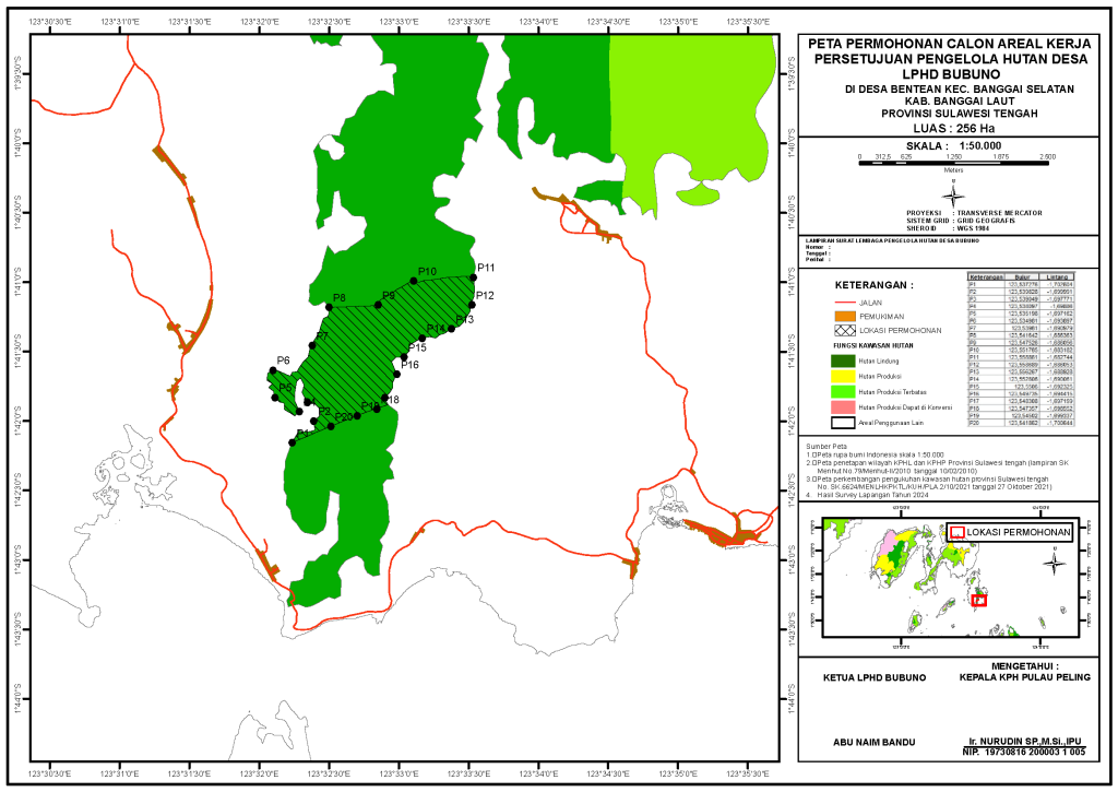
In response to these challenges, the Pulau Peling Forest Management Unit (KPH Pulau Peling), with support from the GCF REDD+ Program, has initiated the proposal of a Social Forestry (Perhutanan Sosial/PS) scheme through the Village Forest (Hutan Desa/HD) mechanism in three target villages, covering a total area of 1,144 hectares: Bentean Village (592 ha), Badumpayan Village (256 ha), and Malino Village (295 ha).
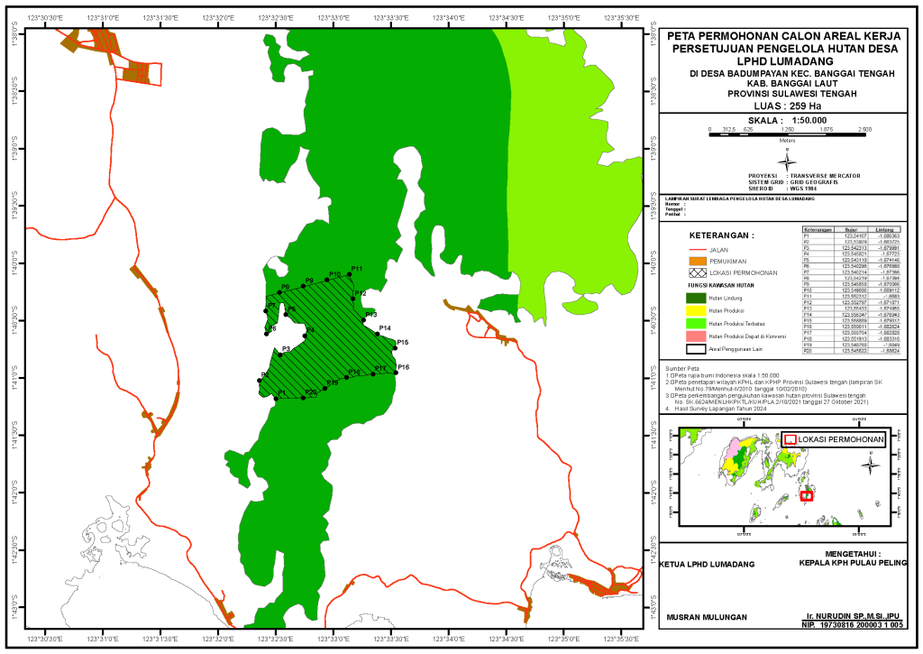
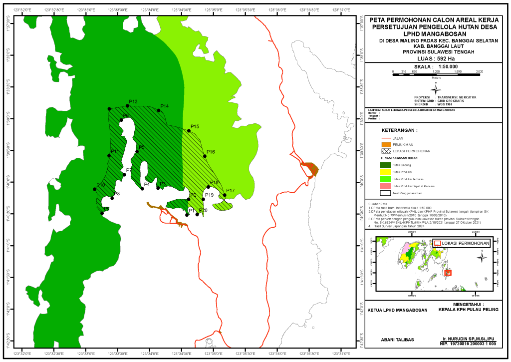
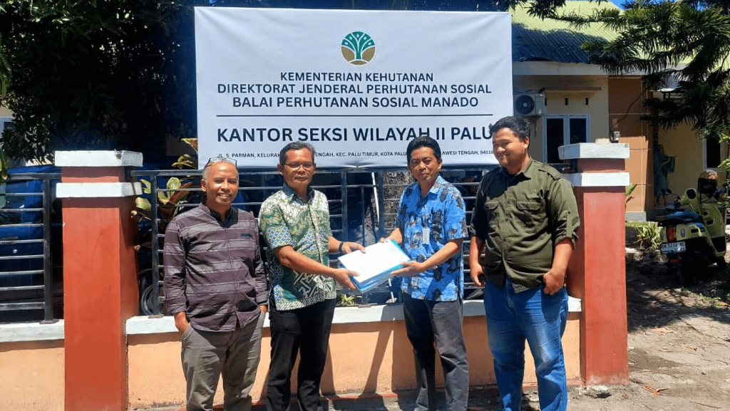
Ir. Nurudin, SP., M.Si., IPU., Head of KPH Pulau Peling, stated that the Social Forestry proposal process in Banggai Laut Regency has been carried out through a participatory approach, including community outreach, group formation, site mapping, and the development of Village Regulations (Perdes).
Nurudin further explained that his institution fully supports the permit application process in the three villages. In addition to ensuring that local communities can legally utilize forest resources, the initiative also aims to protect vital water sources located within the proposed forest areas.
“Besides agricultural lands, water sources in Banggai Laut Regency are crucial assets that must be protected through sustainable forest management. In island regions, the loss of water sources would be disastrous for local communities,” he said.
Beyond supporting Social Forestry initiatives, the GCF REDD+ Central Sulawesi Project, implemented by KEMITRAAN in collaboration with the Provincial Government of Central Sulawesi and supported by the Environmental Fund Management Agency (BPDLH), also contributes to improving forest governance across approximately 135,173.6 hectares of forest areas within the KPH Pulau Peling management landscape, covering both Banggai Laut and Banggai Islands Regencies.
Kiki Rizki Amalia, Project Officer of KEMITRAAN’s Project Management Unit (PMU), explained that the Social Forestry proposal in the KPH Pulau Peling area represents a significant achievement of the GCF REDD+ Central Sulawesi Project in promoting community welfare while ensuring forest conservation.
“The KPH Pulau Peling area has a unique landscape consisting of clusters of both small and large islands, where forest areas are scattered across the archipelago. As we know, island regions are increasingly vulnerable to the impacts of climate change. Social Forestry is one of the key approaches to reducing these risks,” she said.
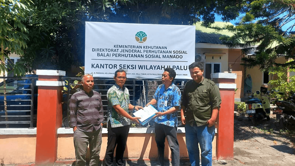
The Social Forestry proposal has been submitted to the Social Forestry and Environmental Partnership Agency (BPSKL) Region II Sulawesi and is currently awaiting technical verification by the Ministry of Forestry.
“While waiting for the approval process, current activities focus on preparing the Social Forestry Work Plan (RKPS) and establishing Social Forestry Business Groups (KUPS) to ensure well-planned and sustainable forest management,” Kiki added.
It is hoped that the proposals from the three villages will soon be approved by the Ministry of Forestry, providing legal certainty for forest management in these areas. At present, Banggai Laut Regency has only two Social Forestry permit holders: Asameo Village Forest and Tolokibit Village Forest, with a combined area of approximately 214 hectares.